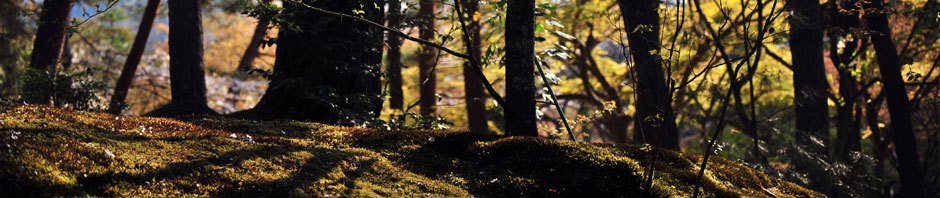
Hikers and mountain bikers alike love the forest preserve at La Cumbre. Miles of old logging roads branch out in many directions, offering very pleasant short outings or all-day excursions to far away places. Using logging roads and trails through the woods, one can travel from La Cumbre all the way to San Agustin Etla or Guacamaya to the west; to the various villages of the Pueblos Mancomunados to the east; to Santa Catarina Ixtepeji to the north and to Huayapam at the foot of the mountains to the south. Many of the mountain slopes are breathtakingly steep, but the roads follow the contours of the land and so have moderate gradients. There are a few high vantage points with wonderful views, but most of the trails are deep in the shadows of the dense forest.
There are two hike options at La Cumbre.
CABEZA DE VACA & MIRADOR TRAIL: This hike will begin on the dirt road leading to the ecotourism camp in the forest. We will leave the road to follow a trail through the woods used each year as part of the course for a mountain bike race held there. The trail will intersect another road we’ll use to climb to a scenic overlook that affords a great view to the hills and valleys extending for miles to the north. After a sack lunch at this mirador, we will retrace our steps back to where we parked our van. This hike is rated moderate to difficult for the length (5.1 miles / 8.2 km) and the amount of elevation gain and loss along the way (1206 feet / 368 meters).
EL CEREZO TRAIL: This second hike begins at the same place as the first, but then proceeds on a steep trail that runs downhill for 3.45 miles to the village of El Punto. It is a point-to-point hike. Be advised this hike is rated difficult because of the terrain. Hiking poles are strongly recommended. People with weak knees or balance issues should not attempt this outing. On the way back to Oaxaca we will stop for lunch on the patio of a lakeside restaurant at one of the Tlalixtac presas.
Time frame: 9 am to 4 pm / Distance: 8.2 Km (5.1 Mi) / Elevation change: 368 M (1206 Ft) gain & loss / Highest point: 3212 M (10,540 Ft) / Type: out & back / Trail: dirt road & footpaths / Exposure: mostly forest shade / Rating: moderate to difficult
Time frame: 9 am to 3:30 pm / Distance: 5.5 Km (3.45 Mi) / Elevation change: 566 M (1858 Ft) downhill / Highest point: 3007 M (9866 Ft) / Type: point to point / Trail: mostly footpath / Exposure: mainly deep forest shade / Rating: difficult


Larry, I would like to join your hike this Friday, February 15th.
Please reply with confirmation, details, meeting time & place et cetera. This is my last week in Oaxaca.
Stan
Hola, Stan!
I have put your name on the list for the hike this coming Friday in Huayapam. You will need to decide whether you are interested in the easy hike or the more difficult one. We will meet, as usual, at the Lending Library at 9 am.