-
Archives
- December 2024
- November 2024
- September 2024
- June 2023
- November 2022
- September 2022
- August 2022
- July 2022
- February 2022
- October 2021
- May 2021
- January 2021
- March 2020
- October 2019
- May 2019
- May 2018
- April 2018
- March 2018
- July 2017
- May 2017
- November 2016
- September 2016
- May 2016
- October 2015
- May 2015
- April 2015
- March 2015
- September 2014
- June 2014
- May 2014
- March 2014
- September 2013
- May 2013
- March 2013
- February 2013
- January 2013
- December 2012
- November 2012
- October 2012
- September 2012
-
Meta
Category Archives: GPS
Ixtlahuaca to Tejalapm – More Information
The rolling hill country on the west side of the Etla Valley is very scenic and a delight to both hikers and mountain bikers. It is a beautiful area at any time of the year, but especially so in the … Continue reading
El Carrizal Loop – More Information
There is a spectacularly lovely high mountain valley north of Tlacolula about 40 miles (59.5 kms) from Oaxaca city which is home to El Carrizal. Historically, El Carrizal is a relatively new community. The story goes that about fifty years … Continue reading
Posted in GPS, Hiking, Photos, Uncategorized
Leave a comment
Tlalixtac / Los Molinos Trail – More Information
This hike in Tlalixtac territory follows a trail wends its way up into a mountain valley. Highway 175 runs up this same valley from Oaxaca to Tierra Colorada, La Cumbre, Guelatao, Ixtlan de Juarez and more distant points. For many … Continue reading
Posted in GPS, Hiking, Photos
Leave a comment
Huitzo Hill Country
Huitzo Hills Hike Option 1 – As with many of the hikes in the “Hoofing It In Oaxaca” program, the hill country around Huitzo was first explored by mountain bike – in this case, a Sunday ride with the Nitos … Continue reading
Posted in Folk Art, GPS, Hiking, Photos
Leave a comment
Zegache to Ocotlan – More Information
The Zapotec artist Rodolfo Morales is best known for his brightly colored surrealistic dream-like canvases and collages, which often feature Mexican women in village settings. He was born 8 May 1925 to working class parents in the town of Ocotlan … Continue reading
Posted in Folk Art, GPS, Hiking, Photos
Leave a comment
Llano Grande – More Information
Of all the villages of the Pueblos Mancomunados, Llano Grande perhaps has the most unique charm, seeming to be a place removed from the normal parameters of space and time. It is a great place to go hiking or mountain … Continue reading
Posted in GPS, Hiking, Photos
Leave a comment
El Picacho – More Information
The name Teotitlán comes from Nahuatl and means “land of the gods”. Its Zapotec name is Xaguixe, which means “at the foot of the mountain”. It is known for its textiles, especially rugs, which are woven on hand-operated looms from wool dyed mainly with local, natural … Continue reading
Posted in Folk Art, GPS, Hiking, Photos
Leave a comment
Cinco Señores – More Information
Hard rock miners were an industrious and inventive lot. Nowhere is this more evident than in the crumbling ruins of the Cinco Señores and Socorro haciendas along a mountain stream that runs between Yavesia and Amatlan in the region of the … Continue reading
Posted in GPS, Hiking, Photos, Uncategorized
Leave a comment
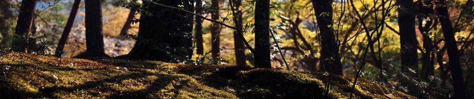
Capulálpam – More Information
Today’s outing is a pleasant walk through the forest on an undulating logging road that eventually becomes a single track trail along a stream. The road is wide and well graded, making for easy going through the woods. The main … Continue reading
Posted in GPS, Hiking, Photos
Leave a comment
Jalapa del Valle – More Information
The short, narrow valley that encompasses the villages of Cienequilla and Jalapa del Valle is a little piece of Eden. Thanks to the Rio Jalapilla which carries fresh water year ’round, local farmers are able to irrigate their fields which, … Continue reading
Posted in GPS, Hiking, Photos
Leave a comment