Category Archives: Photos

Union Zapata Caves – More Information

Visitors to Oaxaca are often interested in the many archeological sites that dot the landscape. Monte Alban, Mitla and Yagul are probably the best known of these. But for the more adventurous, there are hikes to caves in nearby hills … Continue reading

Posted in Archaeological, Folk Art, GPS, Hiking, Photos | Comments Off on Union Zapata Caves – More Information

Mitla Caves – More Information

Our exploration of some of the caves near Mitla will take about two and a half hours of our time, even as we step back in history to the dawn of civilization in the western hemisphere. One of the caves in particular … Continue reading

Posted in Archaeological, GPS, Hiking, Photos | Comments Off on Mitla Caves – More Information

Ixtlahuaca to Tejalapm – More Information

The rolling hill country on the west side of the Etla Valley is very scenic and a delight to both hikers and mountain bikers. It is a beautiful area at any time of the year, but especially so in the … Continue reading

Posted in GPS, Hiking, Photos | Comments Off on Ixtlahuaca to Tejalapm – More Information

“Days of the Dead” in Oaxaca

The Mexican celebration of “Days of the Dead” in Oaxaca is a marvelous cultural experience. It dramatically highlights ancient beliefs about life and death and the interplay between pagan customs and Catholic rituals. For these several days in the fall … Continue reading

Posted in Folk Art, Photos | Comments Off on “Days of the Dead” in Oaxaca

Benito Juárez – More Information

Benit0 Juárez probably sees more visitors from Oaxaca than any of the other villages in the Pueblos Mancomunados simply because it is the closest to the capital city. Another good reason to go there is that it is a great … Continue reading

Posted in Hiking, Photos, Uncategorized | Comments Off on Benito Juárez – More Information

El Carrizal Loop – More Information

There is a spectacularly lovely high mountain valley north of Tlacolula about 40 miles (59.5 kms) from Oaxaca city which is home to El Carrizal. Historically, El Carrizal is a relatively new community. The story goes that about fifty years … Continue reading

Posted in GPS, Hiking, Photos, Uncategorized | Leave a comment

San Miguel del Valle – More Information

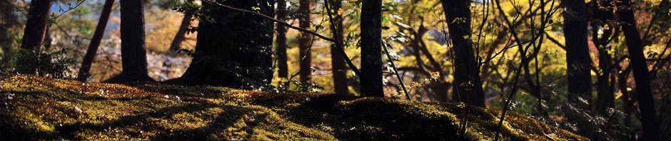
Most of our hikes in the Sierra Norte mountains north of Oaxaca take place in the Pueblos Mancomunados. The territory belonging to San Miguel del Valle borders on the Pueblos Mancomunados, and features the same kind of lush forest and … Continue reading

More Galleries | Leave a comment

Tilcajete – More Information

Alebrijes     Visitors to Oaxaca will find hundreds of fantastically imagined and brightly painted wooden figures for sale in art shops and markets. The carving of alebrijes is a cottage industry here, and supports many families (and not a few … Continue reading

Posted in Folk Art, Hiking, Photos | Leave a comment

Tlalixtac / Los Molinos Trail – More Information

This hike in Tlalixtac territory follows a trail  wends its way up into a mountain valley. Highway 175 runs up this same valley from Oaxaca to Tierra Colorada, La Cumbre, Guelatao, Ixtlan de Juarez and more distant points. For many … Continue reading

Posted in GPS, Hiking, Photos | Leave a comment

Huitzo Hill Country

Huitzo Hills Hike Option 1  –  As with many of the hikes in the “Hoofing It In Oaxaca” program, the hill country around Huitzo was first explored by mountain bike – in this case, a Sunday ride with the Nitos … Continue reading

Posted in Folk Art, GPS, Hiking, Photos | Leave a comment